First Joint International Research Since Eruption of Underwater Volcano Near Tonga AnnouncedAiming to forecast risks and reduce damage from eruptions
The Nippon Foundation and New Zealand’s National Institute of Water and Atmospheric Research (NIWA) announced on April 1 that they would conduct a joint survey of the area around the Hunga Tonga-Hunga-Haʻapai underwater volcano, which erupted in January 2022, and surrounding regions off the coast of Tonga.
Surveys of the area around the underwater volcano since the eruption have yet to be carried out, and the extent of the damage and current situation are not known in detail. This will be the first joint international research since the eruption to visualize the situation in the affected areas of the ocean, and is intended to clarify the risks and provide information that can be used to prevent and mitigate damage from similar undersea volcanic eruptions in the future. The Nippon Foundation and NIWA plan to announce the results in July 2022.
Background
The Hunga Tonga-Hunga-Haʻapai underwater volcano, off the coast of Tonga in the South Pacific roughly 8,000 kilometers from Japan, released a major eruption on January 15, 2022. Before the eruption, part of the volcano was above water and connected the islands of Hunga Tonga and Hunga Ha’apai, but after the eruption the volcano is entirely under water and the two islands have been significantly reduced in size.
Effect on local population and the ocean
According to the Tongan government, four people died and 10 were injured as a result of the eruption, and 84% of the population (approximately 87,000 people) experienced damage. Volcanic ash 30 millimeters thick destroyed crops, livestock, and marine life, and the World Bank estimates that the direct economic loss from the eruption will exceed $90 million (USD). The eruption-triggered tsunami reached beyond Tonga to other countries, affecting ports, ships, and boats. Underwater landslides severed an underwater cable across a 50-kilometer area around the volcano, and telecommunications between Tonga and the outside world were almost completely cut off for several days after the eruption.
In terms of the effect on the ocean, the seafloor topography was altered over an area estimated at more than 8,000 square kilometers and there are concerns of damage to the ecosystem, with the vast coral reefs in the area being suffocated by volcanic ash. No underwater surveys have been carried out in the area since the eruption, however, and details of the effects and current situation in the area are unclear.
Importance of the survey
To forecast the risks and reduce damage from future underwater volcanic eruptions
Both Japan and Tonga are located in subduction zones along the Pacific Plate, and there are many underwater volcanoes near Japan that resemble the one that erupted off Tonga. The survey aims to predict and reduce the economic and social risks of a similar eruption in the future.
Survey overview
Objective
- Collect and release topographical data for approximately 8,000 square kilometers of seafloor to estimate the changes caused by the eruption
- Collect and release basic data to help clarify changes to the environment and ecosystems in that area
Survey methods
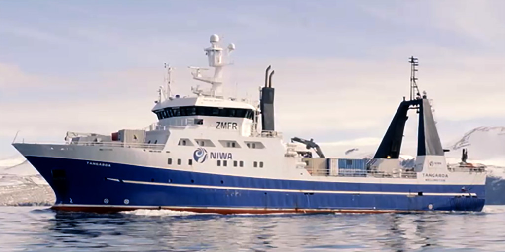
1. Manned survey of the underwater volcano and surrounding sea from a crewed vessel
- Period: April–May 2022 (28 days during this period)
- Location: Sea in the area around the underwater volcano (in permitted areas only)
- Contents: Geological and other features, seafloor topology mapping, video and still photography
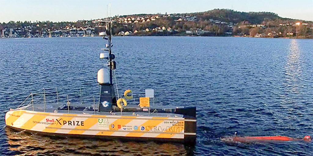
2. Unmanned survey of area around caldera using unmanned surface vehicle (USV)
- Period: April–July 2022 (30 days during this period)
- Location: Caldera and surrounding area (in permitted areas only)
- Contents: Seafloor topology mapping
3. Announcement of analysis of data obtained by crewed vessel and USV and research results (tentatively planned for July 2022)

Comments
Yohei Sasakawa, Chairman, The Nippon Foundation
I am very pleased that this international joint research project has taken shape. The Nippon Foundation has a long track record of human resource development and network-building to address complex and diverse ocean issues. In this survey, too, we will collaborate with various stakeholders to help to understand the condition of the seafloor topography changed by the eruption, and the eruption and tsunami-generation mechanisms, based on the data collected. Our hope is that by capturing the phenomena preceding the eruptions through this research, we can contribute to disaster prevention and mitigation not only for Tonga, but also for Japan and other countries in the volcanically active Pacific region.
Rob Murdoch, General Manager, NIWA
There are 76 submarine volcanoes between New Zealand and Tonga, and 80% of them are said to be active. Understanding the causes of this underwater volcanic eruption is very important for understanding the risks associated with similar eruptions in the future. I am confident that this research will benefit countries in the Pacific region.
About the National Institute of Water and Atmospheric Research
NIWA is a Crown Research Institute established in 1992 to conduct cutting-edge research in environmental science.
It is also hosting the South and West Pacific Ocean Regional Center of The Nippon Foundation-GEBCO Seabed 2030 Project, which aims to map the entire world’s seafloor by 2030.

About The Nippon Foundation-GEBCO Seabed 2030 Project
Launched by The Nippon Foundation and the General Bathymetric Chart of the Oceans (GEBCO), the project aims to map the entire world’s seafloor by 2030.
With the cooperation of government institutes, research institutes, and companies around the world, the portion of the seafloor that has been mapped has increased to 20.6% as of 2021, from 6% in 2017.
Contact
Public Relations Team
The Nippon Foundation
- Email: cc@ps.nippon-foundation.or.jp
